Knowledge Base

Category: Carlson GIS
Topic ID: 790
Title: Carlson GIS Primer
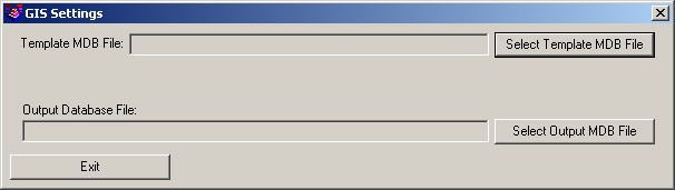
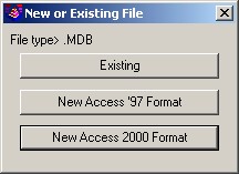
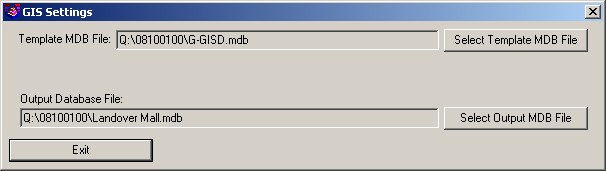
Created: 2013-03-06Last modified: 2024-03-14

Importing ESRI SHP Files

The following material has been developed to serve as a "primer" to describe the initial setup and configuration of Carlson GIS for the purpose of importing ESRI SHP (shape) files.

File Types
Required Files: Optional File(s):
  • SHP
  • DBF
  • SHX
  • PRJ

Procedure

Run GIS Settings

  1. Survey → GIS → GIS Database Settings (or GIS → GIS Data → GIS Database Settings). The GIS Settings dialog box appears.
    GIS Settings
  2. Click Select Template MDB File and identify a source Microsoft Access Database file.
    Select Database
    If a new Access database is created, you will be alerted to run the Define Template Database command.
    Database Alert
  3. Click Select Output MDB File and identify a target Microsoft Access Database file.
    GIS Settings
  4. Click Exit.

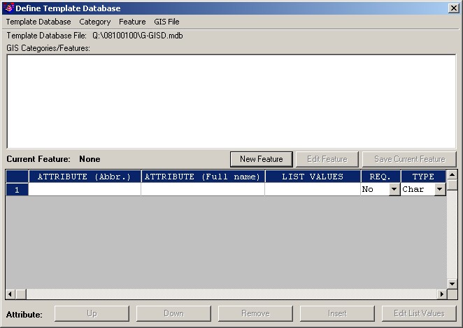
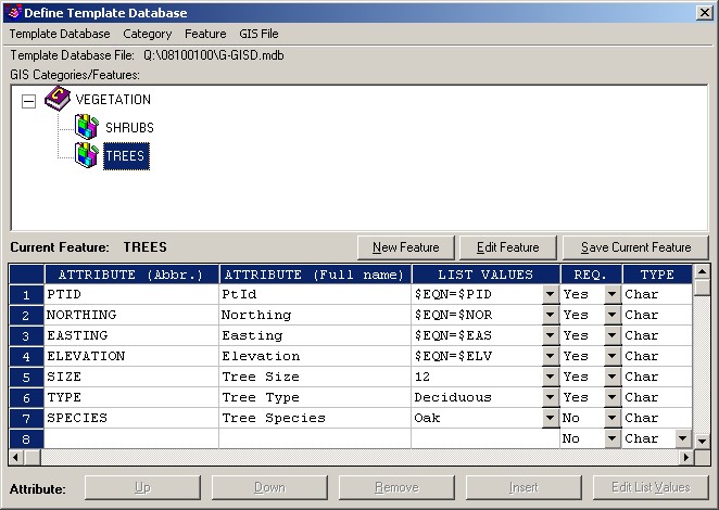
Define Template Database (optional)

  1. Survey → GIS→ Define Template Database (or GIS → GIS Data → Define Template Database).
    Template Database
  2. From the Category menu, click New to create a new Category (collections of database tables). Once created, make sure the appropriate Category is selected before creating a Feature.
  3. From the Feature menu, click New to create a new Feature (database tables). Once created, make sure the appropriate Feature is selected before creating Attributes.
  4. Create Attributes (table fields) to house the data you wish to collect about the Feature.
    Define Template Database
  5. From the Template Database menu, click Exit.

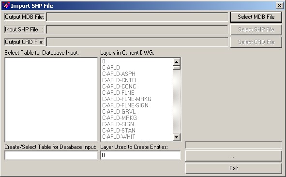
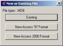
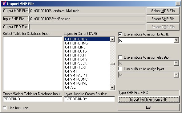
Import ESRI SHP File

  1. Survey → GIS → Import SHP File (or GIS → GIS Data → Import SHP File). The Import SHP File dialog box appears.
    Import SHP
  2. If not already specified from the GIS Settings, click Select MDB File and identify a target Microsoft Access Database file.
    Identify Database
  3. Click Select SHP File and identify a source ESRI SHP file.
  4. Provide the necessary mappings from the the SHP file.
    Import SHP File
  5. Click the Import Polylines from SHP button.
  6. As needed, issue a Zoom → Extents.

For More Information on SHP Files

http://en.wikipedia.org/wiki/Shapefile

Links:
Attachments:
ImportSHP01-GISSettings.jpg
ImportSHP02-GetDatabase.jpg
ImportSHP03-PromptsAlert.jpg
ImportSHP04-GISSettings.jpg
ImportSHP05-DefineTemplateDatabase.jpg
ImportSHP06-DefineTemplateDatabase.jpg
ImportSHP07-ImportSHPFile.jpg
ImportSHP08-GetMDBFile.jpg
ImportSHP09-ImportSHPFile.jpg
Keywords:
File
shape